

Ben Siebrase

Audio By Carbonatix
I hiked over 75 trails with my kids last year while writing the just-released Hiking With Kids Colorado: 52 Great Hikes for Families (Falcon Guides).
Maybe you want to know where to hike with your own children…or maybe you’re not a kid person and just need to know what family-friendly trails to avoid. Either way, here are a few crowd-pleasers from that book – all easily accessible from Denver and great options for anyone who wants to get outdoors with children, dogs, a friend or partner…or nobody at all.
Pine View Trail (Pine)
Distance: 2.5-mile loop
Hiking time: 1.5-3 hours
Finding the trailhead: From Conifer, take US 285 south for 6.7 miles. At the Pine Junction County Store, turn left onto Pine Valley Road. Cell phone service is spotty. In 6 miles, turn right onto Crystal Lake Road; follow the signs to Pine Valley Ranch Park. Park in the third lot at the end of the road. The trailhead is near the outhouse.
Anchored by Pine Lake, Pine Valley Ranch Park is an 883-acre treasure with miles of secluded trails shaded by thick strands of conifers growing along the north edge of Pike National Forest. All the park’s trails are easy to follow, but Pine View is especially fun for families looking for a low-mileage hike with a backcountry feel.
After snapping a photo of your kids on the bridge (just past the parking lot), follow the wheelchair-access sign to merge onto the Pine Lake Loop. Stroll alongside the stream until the paved sidewalk becomes a dirt path.
Turn left at the staircase to begin a steep ascent up Park View Trail. Watch young kids closely near the ledge. Switchbacks ease the final push toward the top, and then Park View Trail flattens out significantly.
The trail dips into Pike National Forest before ending at 1.1 miles. Bear right onto Strawberry Jack Trail to loop back to Pine Valley Ranch. It’s all downhill from here, as the trail drops into a dense aspen grove.
Turn right onto Buck Gulch Trail. When you reach the junction at 2.15 miles, go either way around Pine Lake, a popular stop for anglers. If you have a pole, cast a line from one of the piers post-hike. (A Colorado state fishing license is required.) The beautiful stone pavilion overlooking the lake is an ideal place for a picnic, too.
Eldorado Canyon Trail (Boulder)
Distance: 3.8 miles out and back
Hiking time: 2-4 hours
Finding the trailhead: From CO 36, take the Louisville-Superior exit and go left (south) on McCaslin Boulevard. Almost immediately, turn right (west) onto Marshall Road and wind through Superior Marketplace. Continue driving west for about 6 miles. The road becomes dirt as it passes through the offbeat town of Eldorado Springs. Do not park in town. Continue following CO 170 to the Eldorado State Park main entrance. Drive through the park, cross a small bridge, and steer left to follow signs to the visitor center.
It’s no wonder Eldorado Canyon State Park has been the backdrop for commercials and documentaries. Even from the parking lot, the views are spectacular!
Eldorado Canyon is divided into two main sections: the Inner Canyon and Crescent Meadows. The park’s three major trails – Fowler, Rattlesnake Gulch and Eldorado Canyon – depart from the Inner Canyon.
Eldorado Canyon Trail is a sunny route that tends to get less foot traffic than other trails inside the park. The hike takes off from a kiosk outside the visitor center. After climbing stone and wood stairs and crossing a road, the first section of the hike is a challenging 1,000-foot ascent with excellent views.
Switchbacks ease the climb, and benches offer break points. Past the second bench, after a big bend, pass the turnoff for Rincon Wall. Don’t turn right onto this climbing-access trail. Instead, continue along the main trail, which is much wider.
The hardest part of the hike is over. Even so, families with young children can use the Rincon Wall junction and overlook as a “summit.” If you’re up for more, continue following the Eldorado Canyon Trail as it dips into a forest of ponderosa pine and Rocky Mountain juniper.
Cross through a field of boulders, and beware of talus fields nearby. The rocks are extremely unstable; when they’re disturbed, they’ll roll down until they find a stopping point, creating a potentially dangerous situation for hikers. Supervise children and pets, and don’t go off-trail.
After crossing a small bridge, you’re almost to the top of the hill. In another 0.3 miles, the trail weaves out of the forest, opening to sensational views of the Continental Divide. Eldorado Canyon Trail continues on for another 1.4 miles until terminating at the Walker Ranch Loop Trail. It’s possible to complete a 14-mile lollipop by combining these two trails, but that’s very ambitious.
Instead, stop at the scenic overlook at 1.85 miles (GPS coordinates: 39.94136 / -105.30329). Turn around and retrace your steps to the trailhead.
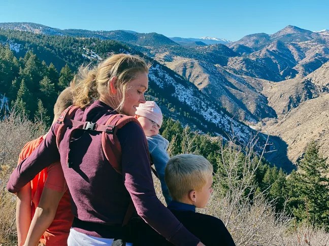
The author with her entourage.
Ben Siebrase
The Braille Trail Loop (Genesee)
Distance: 1.65-mile lollipop
Hiking time: 1-2 hours
Finding the trailhead: I-70 bisects Genesee Mountain Park. Take exit 253 – bypassing the Genesee Park exit (254) if you’re coming from Denver – and drive north to Stapleton and Moss Rock roads. Turn right onto Stapleton Road. Follow it for about half a mile to a parking lot, on the left.
There’s a lot to love about Genesee Mountain Park, especially the Braille Trail, a short route that’s perfect for beginner hikers. Kick things off at the Bison Overlook (across from the trailhead). In 1914, when bison and elk neared extinction, Denver acquired herds at Yellowstone Park to introduce into the city’s very first mountain park.
The hike begins near the outhouse, at Beaver Brook Trailhead. Reach the Braille Trail via the historic Beaver Brook Trail, bordered by wild lupine and Queen Anne’s lace. Begin walking slightly downhill, then make a sharp right at the intersection at 0.4 miles, and descend to a service road.
After crossing the road, you’ll come to a Braille Trail sign and guideline. The Braille Trail is an accessible route designed for hikers with vision impairments. In addition to the waist-high guideline, the trail’s interpretive signs are written in Braille.
This incredible trail slopes downhill alongside a babbling creek. Be mindful of rocks and roots during the descent. After passing several barricades and following stairs to the creek bed, you’ll reach a cute wooden bridge and a fork. Go left at the fork to complete the Braille Trail Loop. Back at the beginning of the loop, turn right, cross the service road, and retrace your steps to the trailhead.
For more, pick up a copy of Hiking With Kids Colorado at one of many local bookstores, including the Bookies, Tattered Cover, BookBar and Covered Treasures. You can also buy it at falcon.com/books, and through Barnes & Noble, Amazon and Books-A-Million.