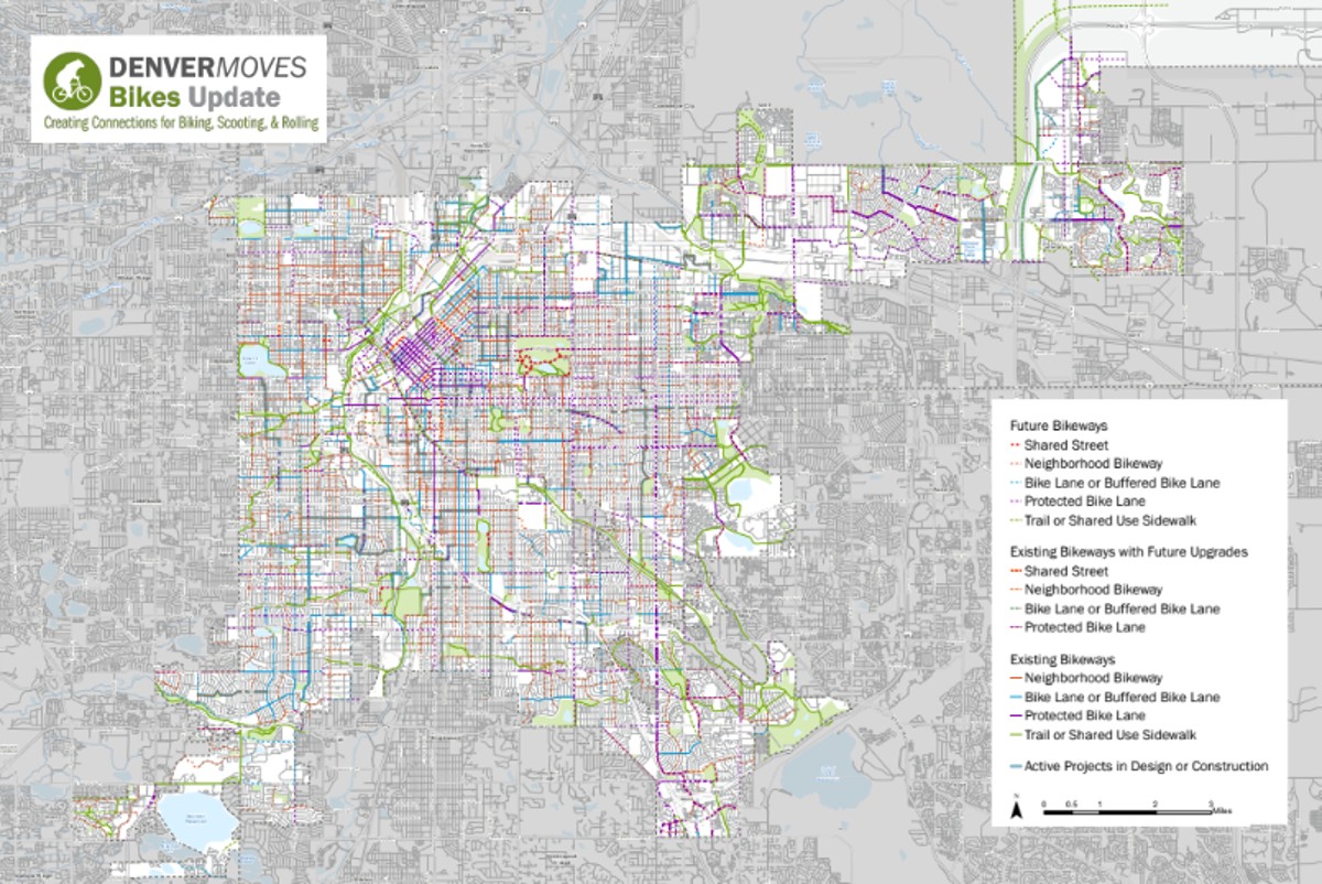

Earlier this month, DOTI began the second phase of Denver Moves: Bikes, which was created to improve the city's patchwork of bike trails. As the second phase began this summer, DOTI published an interactive map of what Denver's new network of bike paths will look like before the department adjusts the map once more.
Collecting feedback from residents for proposed bikeways is also part of the second phase. Residents have until mid-September to view the new map and submit their thoughts, questions or concerns, which can both be done online.
DOTI hosted a virtual open house on August 7 to introduce the new map of proposed improvements. It shows a spread of dotted lines across Denver where the city plans to create new or clearer bikeways.
Taylor Phillips, a senior city planner, noted during the open house that even though the new map is loaded with dotted lines showing potential new bikeways, those lines show the direction of a planning process that will unfold over the next two decades. Some of the new bikeways on the map are in design or under construction, according to DOTI.
"Are you going to go and build all this tomorrow? What do all these lines on the map mean? And the answer is, no, we don't have enough money to go build all the lines on the map tomorrow," Phillips said."This is our twenty-year vision for how we're going to use our existing and hopefully future funding sources to be able to expand our bike network."
Denver's current bike map was created in 2015, and every decade, DOTI updates its map and its recommendations for where to create new bikeways. Current efforts to update the map has netted feedback on DOTI's current map from more than 3,000 residents since November 2023.
The first phase of the project gathered feedback on Denver's current bike map, and the second is meant for feedback on the new map, which lays out ideas from DOTI to make improvements based on feedback from the first phase. The second, final phase is expected to finish this fall.Bikeways include neighborhood streets, shared streets, bike lanes, trails and shared-use sidewalks. Denver has more than 500 miles of bikeways, but they're not connected by a contiguous citywide network.
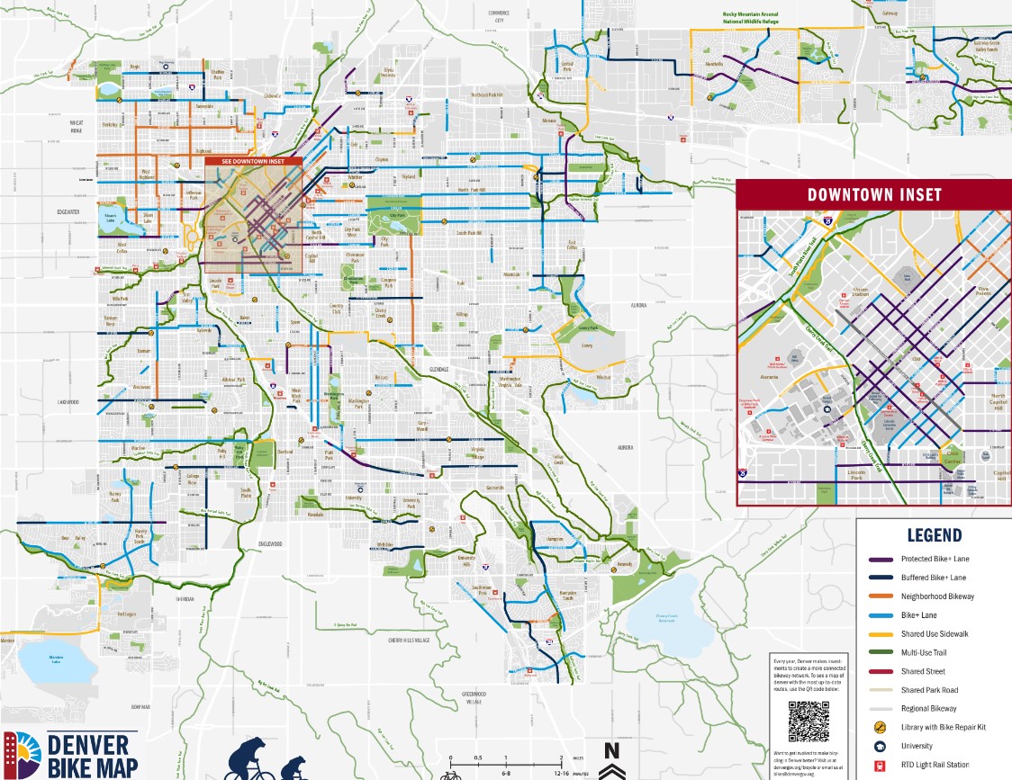
Denver's current bike map has huge gaps where the city's bikeways end and don't connect to longer trails or lanes. It can make biking confusing and unsafe.
Courtesy of DOTI
Breaking Down Denver Bikeway Troubles Across Town
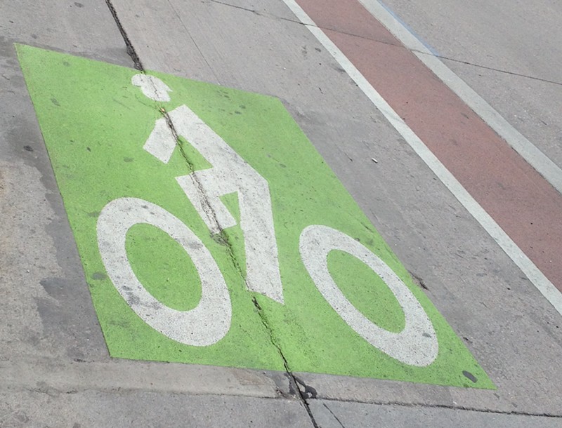
Local cyclists know that short of huge trails like Cherry Creek Trail, Denver bikeways are mostly choppy and unconnected, largely because of the layout of bike lanes. Bike lanes that run along streets seem to suddenly stop or disappear, and others don't offer a direct way onto longer, unbroken trails.
Phillips acknowledged the city is trying to improve "those one-off bikeways to nowhere all over town that don't really connect to anything and aren't very helpful" at the August 7 open house.
In east Denver, the Hale neighborhood has no bike lanes, while Montclair and Hilltop each have only one bike lane, which are both shorter than a mile long and come from and lead to nowhere. Phillips acknowledged the city is trying to improve "those one-off bikeways to nowhere all over town that don't really connect to anything and aren't very helpful" at the August 7 open house.
Cyclists on these bikeways often have to connect to other areas with ad hoc routes, which requires biking onto sidewalks or high-traffic streets. Denver's current bike map shows random stranded segments of trail in the middle of neighborhoods, as well as long stretches without any connection to major trails.
In west Denver, Baker has a half-mile buffered bike lane on West Third Avenue, but it's blocks from the homes, parks or residential roads that connect it to other lanes and trails.
A few neighborhood bikeways near DIA will only take cyclists about a mile or less up and down streets near Tower Road.
Denver also has spots where different bikeways connect to each other, but only within a small pocket, and not to a major, citywide network of bikeways.
Southwest Denver has more than a dozen miles of trails and lanes around Marston Reservoir and in Harvey Park that connect to each other, but not to routes that go beyond the area.
Green Valley Ranch has close to a dozen miles of trails — including a nine-mile section of the High Line Canal — and miles of bike lanes, but none of them connect to bikeways west of Peña Boulevard. The High Line Canal trail can take residents farther south, but in the other direction, the canal ends a few miles north of the neighborhood.
In University Park, there is a five-mile protected bike lane along East Yale Avenue that only connects to the Harvard Gulch Trail, which in turn ends in Harvard Gulch Park with no way to go beyond East Iliff Avenue or South Logan Street.
The city wants to fill all these gaps with a "core network." It would be a series of "bikeways that take direct paths across the city and will be upgraded over time to accommodate higher volumes of people biking and scooting," according to DOTI.
DOTI will wrap up its community outreach process in the fall. It expects to have a final map posted online by December.